Rare Cloud Formations to Look For
Most folks stroll outdoors, spotting fluffy white blobs drifting above. Yet take a real look – nature’s sketching wild, stunning shapes up there.
Certain clouds curl like ocean swells. Meanwhile, several shimmer with shades you’d swear can’t exist.
Once in a blue moon, rare ones show up, making shutterbugs camp out for ages just to snap one. These shapes form when certain factors come together – like changes in heat, air movement, humidity, or height, each one contributing.
No special gear is needed to see them. Just pay attention to the right clues while staying calm and waiting.
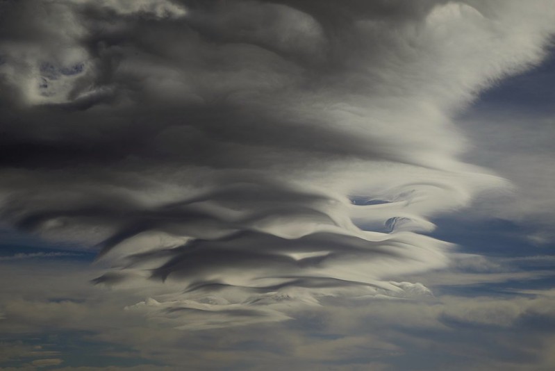
Lenticular Clouds
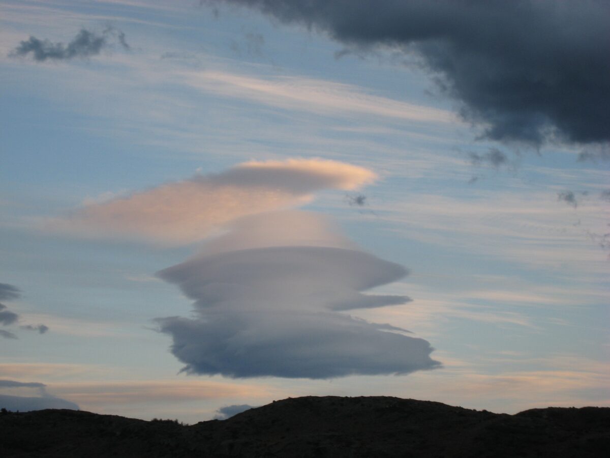
Lenticular clouds appear when airflow slams into a mountain, triggering ripple patterns downwind. Moisture clumps together at the top of those ripples – shaping smooth, saucer-like formations.
They just sit there, motionless, even though gusts tear right through.
They pile up like pancakes now and then, layer after layer. Folks often think they’re UFOs since they appear so sharp-edged and still.
These shapes show best near peaks in California, Oregon – also Washington – where air patterns help form them.
Mammatus Clouds
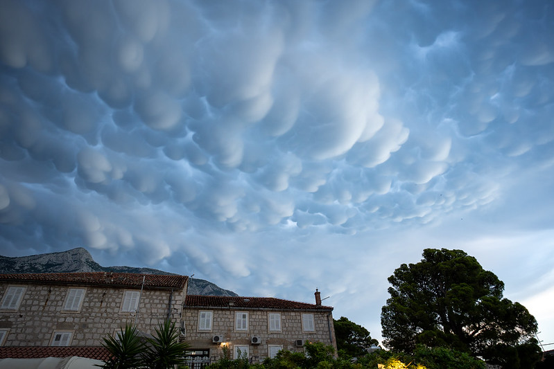
The pouches dangling below mammatus clouds make it seem like the heavens are dripping. These blobby shapes appear as chilly air drops into milder layers, shaping sack-like bulges spreading across vast stretches overhead.
You’ll spot these mostly once big storms have moved on. They might stick around for just minutes or stretch past sixty, yet seeing how they twist and drift pulls you in.
Despite their short life, each movement seems to dance unpredictably.
Noctilucent Clouds
Noctilucent clouds glow at night, perched way up where sunbeams reach even when it’s dark below. These wisps appear nearly 80 kilometers high – far above regular clouds – in the chilly mesosphere.
That layer gets crazy cold, dipping near -130°C. Sunlight scatters off ice crystals there, making them sparkle like faint silver streaks. You’ll see these only in summer near the poles – places like Alaska, northern Canada, parts of Scandinavia, or far southern South America.
Appearing as faint glowing streaks, they hang softly in the twilight air.
Kelvin-Helmholtz Clouds
Wind shear forms Kelvin-Helmholtz clouds – wavy shapes like sea swells stuck mid-air. One layer of air slides over another at a different pace, creating friction between them; this rough interaction builds curling cloud edges that mimic crashing waves.
They vanish fast – often within minutes after forming. Those flying bump into them way more than folks below, given they pop up high in the sky then fade quickly.
Morning Glory Clouds

Morning Glory clouds sweep over northern Australia, looking like giant cylinders that stretch for hundreds of miles. These formations race forward – some hit 35 mph – with several rolling side by side, occasionally lining up as a group of eight.
The tiny place called Burketown in Queensland spots those best from September into October. Yet glider flyers come from everywhere just to soar on the rising air these clouds make.
Nacreous Clouds
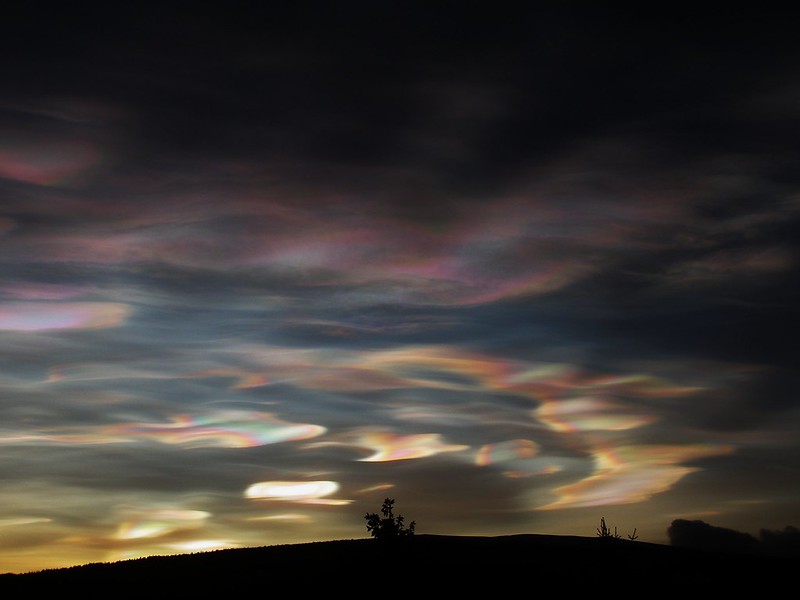
The rainbow shades in these cloud types seem unreal, as if a brush dipped in color swept across the sky. Because they develop high above the poles where it’s colder than -108°F, moisture freezes into fine ice bits.
These particles bend sunlight, creating glowing ripples that shift with movement. You’ll usually see these lights during winter months up north – think spots like Norway, Alaska, or even far-down places such as Antarctica.
Right after dark falls or just before daylight returns, they show up when the sun sits roughly 1 to 6 degrees under the edge of the sky.
Asperitas Clouds
Asperitas clouds twist, almost as if you’re staring at sea swells from beneath the water. The shape seems messy – yet oddly structured – with deep rolling ridges stretching across the whole horizon.
While one part heaves upward, another dips down, forming a restless ceiling overhead. Though wild in appearance, there’s a rhythm hiding within the turmoil.
The World Meteorological Organization gave this cloud official status in 2017 – first fresh category in years. These clouds show up around thunderstorms, yet experts aren’t fully sure what causes their wild look.
Fallstreak Pits
A round pit breaks through clouds when fallstreaks show up – almost like a circle was punched into the heavens. Water droplets freeze suddenly, turning into ice bits that drop down, opening up empty space behind.
The ice bits dropping down leave wispy trails known as virga. When aircraft move through certain air layers, they spark these shapes – now round, now stretched or uneven.
Pileus Clouds
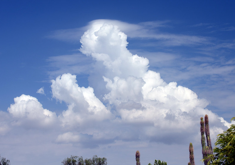
Pileus clouds sit on top of building cumulions like soft hats. These appear once warm air surging upward breaks into a calm level overhead, making water vapor turn into that dome-shaped layer.
These tend to stick around only briefly until the intense upward wind swallows them up or breaks right through. Look for them mostly in warm months, ’cause that’s when rising heat creates those tall fluffy cloud piles.
Roll Clouds
A lone tube-shaped cloud spins on its side, showing what roll clouds look like – they travel apart from the main sky cover up top. Because of this, they pop up near storm edges or when ocean winds push into other pockets of air.
Not like shelf clouds, these break away entirely from the main storm. While some extend hundreds of miles, others move slowly beside coasts for hours – forming a strange rolling tube that almost looks alive.
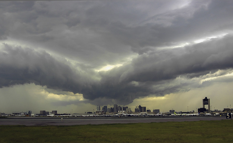
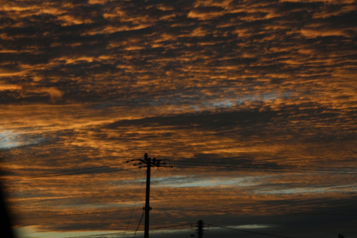
Shelf Clouds
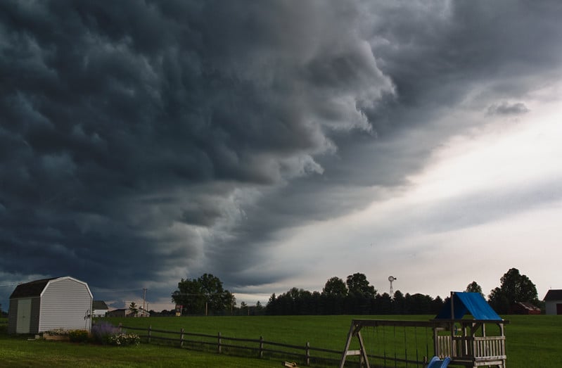
The front edge of a storm usually looks like a shelf cloud – this forms where cool sinking air meets warmer air in front. A sudden drop in height means rough weather’s about to hit.
Those clouds seem scary – and no wonder, since fierce gusts plus downpours usually come right after. They might stretch across many miles while turning slightly green if the air’s just right.
Pyrocumulus Clouds
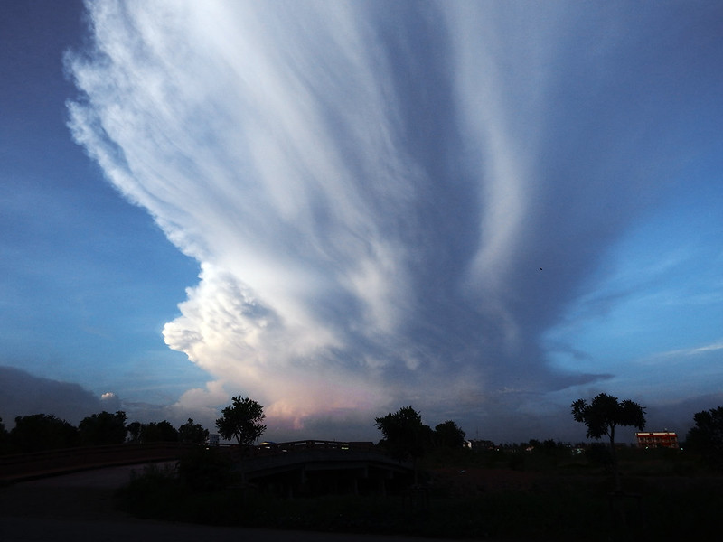
Blazing fires send up thick plumes, forming cloud towers over the burning zone. Heat from the blaze stirs wild shifts in airflow – moisture gathers as warm currents climb fast.
Some of these cloud forms grow into big storm systems known as pyrocumulonimbus, often sparking lightning – this can trigger fresh blazes. Crews keep a close eye on such signs because they signal intense fire activity along with sudden shifts in how flames spread.
Contrail Clouds
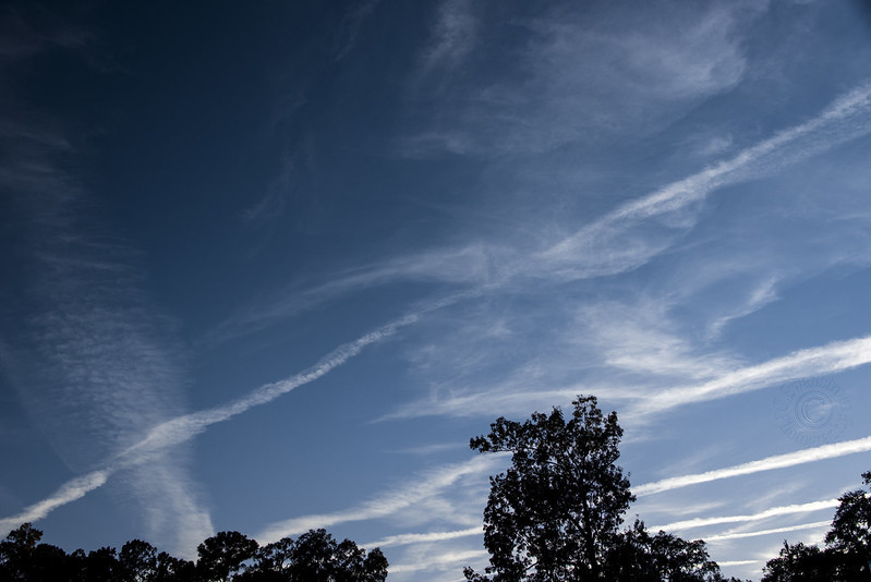
Aircraft engines make icy streaks as hot fumes meet freezing air, making moisture turn sharp into tiny ice bits. Still, those lines map where planes flew – lingering long if winds or sun don’t scatter them.
Now and then, these paths stretch out way beyond, blending into faint fake clouds that cover big chunks of the sky. How they form relies mostly on how high the plane is flying, but also gets tweaked by how chilly and damp the air around it happens to be
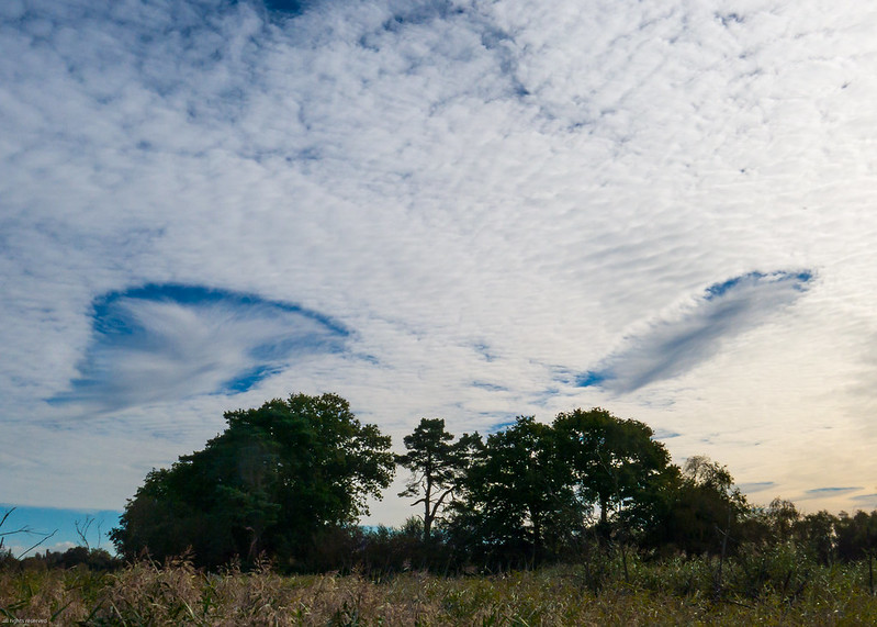
When the Sky Tells Its Story
Looking up changes when you see what’s actually out there. That faint streak across the horizon?
Could be a Morning Glory moving in slowly. Those odd sac-like shapes drooping underneath – maybe mammatus clouds showing the storm’s losing strength.
The sky keeps playing games. But sometimes, when it matters, take a glance upward.
More from Go2Tutors!

- The Romanov Crown Jewels and Their Tragic Fate
- 13 Historical Mysteries That Science Still Can’t Solve
- Famous Hoaxes That Fooled the World for Years
- 15 Child Stars with Tragic Adult Lives
- 16 Famous Jewelry Pieces in History
Like Go2Tutors’s content? Follow us on MSN.