15 Route 20 Facts About America’s Longest Road
Most people think Interstate 80 or Route 66 when they picture America’s epic cross-country drives. But there’s this other highway that quietly stretches further than any of them – U.S. Route 20.
It’s not as famous as Route 66, doesn’t have the same mystique, but it goes from one end of the country to the other without much fanfare. This road has been around since the 1920s, connecting small towns and big cities across the northern part of the United States.
It’s seen everything from Model T Fords to modern electric cars, and somehow it just keeps going. Here is a list of 15 facts about Route 20 that show why America’s longest road deserves more respect.
It’s Over 3,300 Miles Long

Route 20 stretches 3,365 miles from Boston, Massachusetts to Newport, Oregon. That’s longer than driving from New York to London would be if you could somehow build a bridge across the Atlantic Ocean.
The whole trip takes about 60 hours of straight driving, assuming you don’t stop for gas, food, or sleep.
It Goes Through 12 Different States

Starting in Massachusetts, Route 20 cuts through New York, Pennsylvania, Ohio, Indiana, Illinois, Iowa, Nebraska, Wyoming, Montana, Idaho, and finally Oregon. Each state has its own personality along the route, from New England villages to Great Plains farmland to Rocky Mountain passes.
It’s like taking a geography lesson at 65 miles per hour.
Like Go2Tutors’s content? Follow us on MSN.
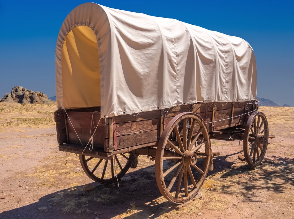
The Road Follows Historic Trails
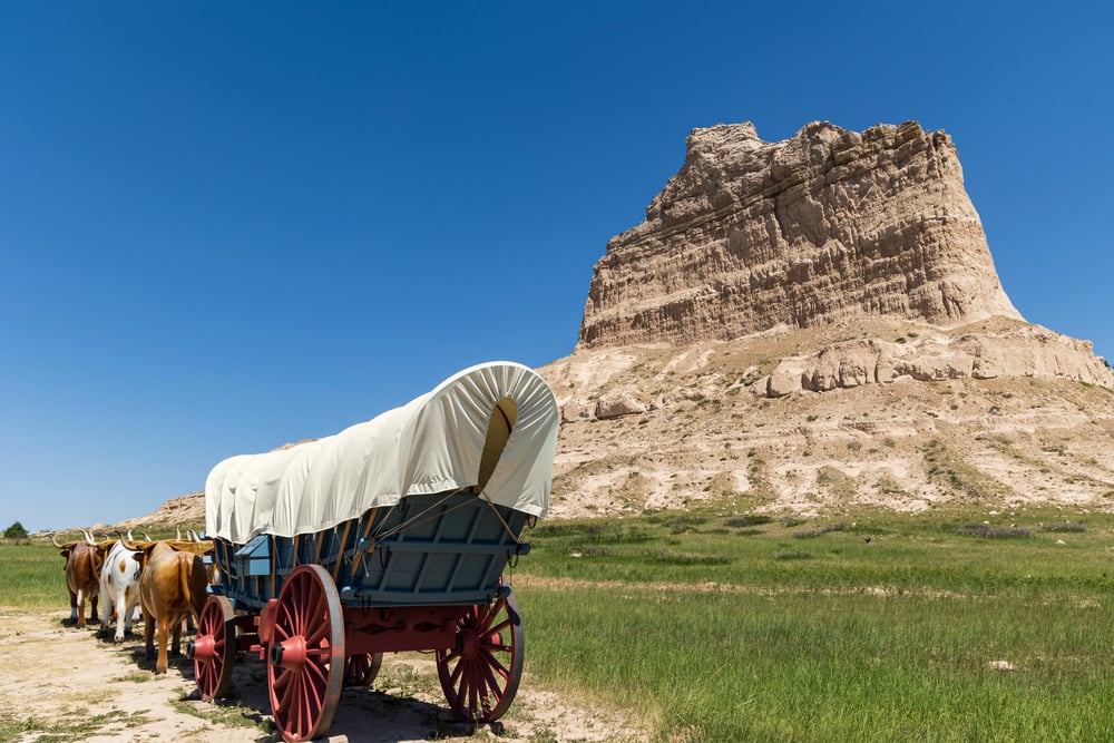
Much of Route 20 runs along paths that Native Americans and early settlers used for centuries. In some places, it follows the old Oregon Trail that pioneers took to reach the West Coast in covered wagons.
Modern drivers are basically cruising down the same routes that people walked behind oxen 150 years ago.
It Crosses the Continental Divide Twice
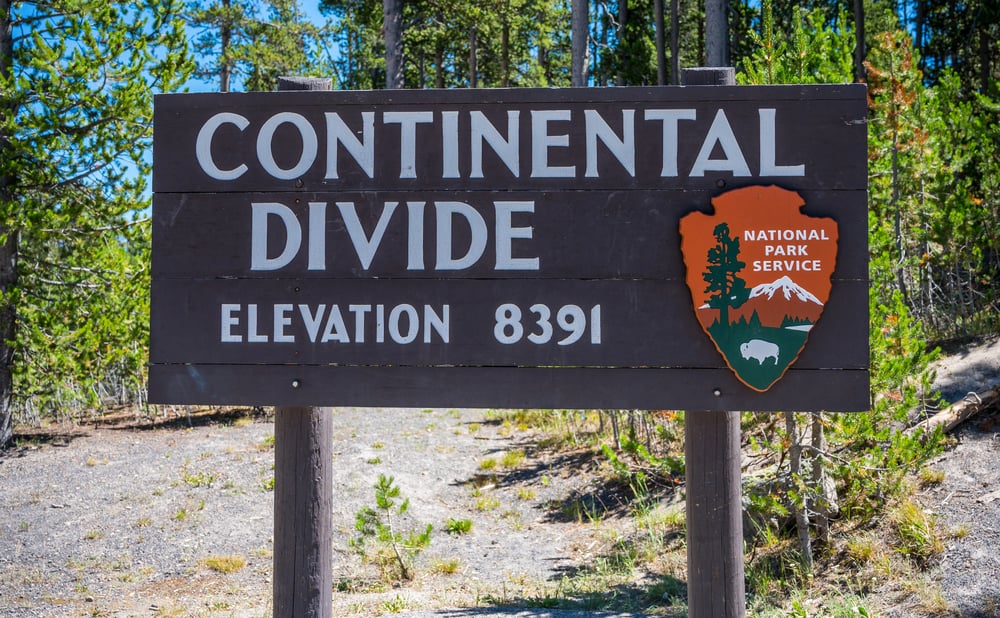
Route 20 hits the Continental Divide at two different spots in Wyoming and Montana, both over 8,000 feet above sea level. At these points, rain falling on one side of the road eventually flows to the Pacific Ocean, while rain on the other side heads toward the Atlantic.
It’s one of those weird geographic facts that makes you feel like you’re standing on top of the world.
Yellowstone National Park Sits Right on It

The road runs straight through Yellowstone National Park, making it one of the few highways that bisects a major national park. During winter, parts of the route through Yellowstone close completely due to snow, which can mess up cross-country travel plans.
Summer traffic jams caused by bison wandering onto the road are just part of the Route 20 experience.
Like Go2Tutors’s content? Follow us on MSN.
Boston Common Is Mile Zero

Route 20 officially starts at Boston Common, right in the heart of one of America’s oldest cities. There’s a small marker there, though most tourists walking around the park probably don’t even notice it.
From that spot, you could theoretically drive all the way to the Pacific Ocean without ever leaving Route 20.
It Passes Through Tornado Alley

The middle section of Route 20 goes right through some of the most tornado-prone areas in the United States. Spring and early summer driving through Nebraska and Iowa means keeping an eye on the weather radar and knowing where the nearest sturdy building is located.
Storm chasers often use Route 20 as their main highway for following severe weather systems.
The Oregon Trail Museum Sits Along the Route

In Nebraska, Route 20 passes right by several Oregon Trail landmarks and museums. You can still see wagon ruts carved into the prairie from thousands of pioneer families who made the journey west.
It’s pretty wild to think about people walking the same path you’re driving, except they took months to cover ground you can cross in a day.
Like Go2Tutors’s content? Follow us on MSN.
It Goes Through the Middle of Nowhere

Long stretches of Route 20, especially through Nebraska and Wyoming, have almost nothing for miles and miles. Some sections go 50 miles or more between gas stations, which can make for some nervous moments if your fuel gauge is running low.
The emptiness is both peaceful and slightly terrifying, depending on your perspective.
Grand Teton National Park Borders the Highway
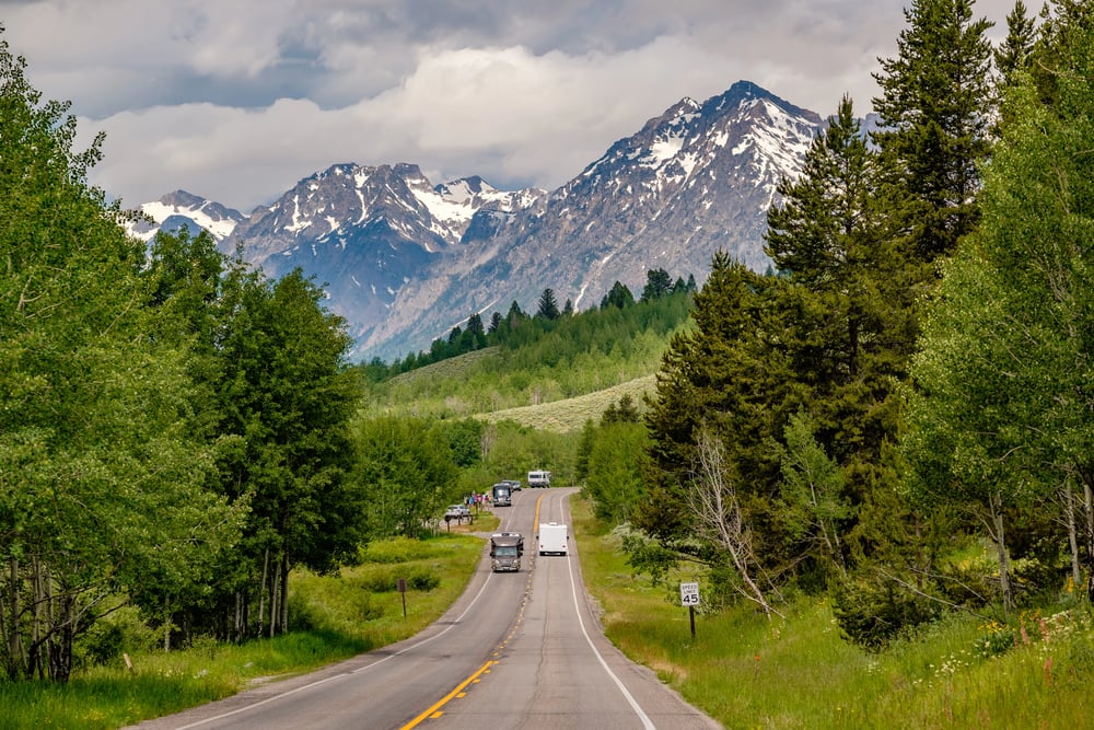
Route 20 runs along the southern edge of Grand Teton National Park in Wyoming, offering some of the most spectacular mountain views of any highway in America. On clear days, the Teton Range rises up like a wall of granite and snow right next to the road.
It’s the kind of scenery that makes people pull over just to take pictures.
Small Towns Depend on Route 20 Traffic
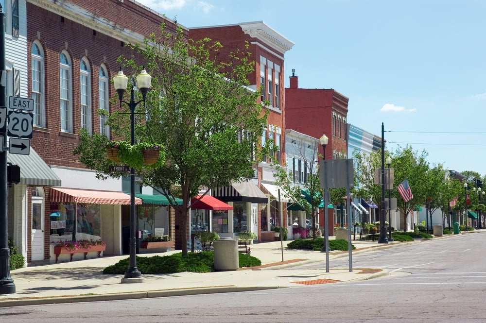
Dozens of small towns along Route 20 exist mainly because of the highway traffic passing through. Places like Valentine, Nebraska and Cody, Wyoming built their economies around providing gas, food, and lodging to cross-country travelers.
Without Route 20, many of these communities would probably dry up and blow away.
Like Go2Tutors’s content? Follow us on MSN.
It’s Older Than the Interstate System

Route 20 was designated in 1926, more than 30 years before President Eisenhower signed the Interstate Highway Act. Back then, cross-country highways were just numbered routes that connected existing local roads, not the engineered superhighways we have today.
Route 20 has been patched, repaved, and rerouted countless times, but it’s still basically the same road that opened in the 1920s.
Winter Driving Can Be Brutal
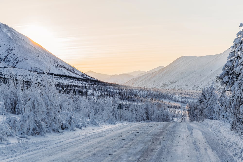
The northern route of Highway 20 means dealing with some of the worst winter weather in the United States. Blizzards in Wyoming and Montana can shut down sections of the road for days at a time.
Even when it’s open, winter driving through places like Togwotee Pass requires chains, extra food, and a lot of patience.
It Connects Major Cities You Wouldn’t Expect

Route 20 links cities that don’t seem like they should be connected – Boston and Boise, Albany and Omaha. The road creates relationships between places that are thousands of miles apart but share the same highway number.
Local businesses along the route often display signs showing distances to far-off cities that most residents will never visit.
Like Go2Tutors’s content? Follow us on MSN.
The Pacific Ocean Endpoint Is Pretty Quiet

Route 20 ends at the Pacific Ocean in Newport, Oregon, but there’s no big fanfare or famous landmark marking the spot. It just sort of stops at Highway 101 near the coast, without much ceremony for being the end of America’s longest road.
After 3,365 miles of driving, you’d expect more than a regular intersection, but that’s Route 20 for you – practical and unpretentious right to the end.
From Horse Trails to Highway Legends
What started as Native American paths and pioneer trails has become a modern cross-country lifeline that still connects communities the way it did nearly 100 years ago. Route 20 might not have the fame of other highways, but it quietly carried millions of travelers across the continent while small towns grew up around it and America changed around it.
Today’s GPS-guided drivers are following the same basic route that covered wagon families used to reach new lives out west. The road that once took pioneers months to travel now takes weekend warriors just a few days, but it still represents the same American spirit of heading somewhere new and seeing what’s over the next ridge.
More from Go2Tutors!

- 16 Historical Figures Who Were Nothing Like You Think
- 12 Things Sold in the 80s That Are Now Illegal
- 15 VHS Tapes That Could Be Worth Thousands
- 17 Historical “What Ifs” That Would Have Changed Everything
- 18 TV Shows That Vanished Without a Finale
Like Go2Tutors’s content? Follow us on MSN.